

Flat Earth - Satellite Image Viewer
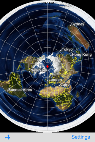
This is an application that displays satellite images of whole earth in Azimuthal Equidistant projection centering on arbitrary points.
Directions:
Double tap: Move the center of projection.
Pan: Translate maps (only in the translation mode). Revolve maps around the center of projection (only in the rotation mode).
Pinch: Zoom in or zoom out on maps (only in the translation mode).
The button on the left side of the toolbar: Switch between the translation and the rotation mode.
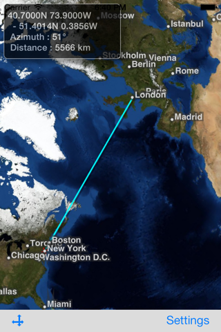
Long Press on the map: Display the shortest path between the center and the long-pressed point. Also, calculate the azimuth clockwise from North and the distance between these points, and show them in a text view. When tap the text view, the text view and the path disappear.
Tap the page curl button in the lower-right corner:
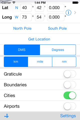
- Show/Hide lines of latitude and longitude.
- Show/Hide boundaries of countries.
- Show/Hide names of major cities.
- Show/Hide major airports. (Their names are visible when zooming in.)
- Center of projection can be specified in either of the following ways:
- entering longitude and latitude manually,
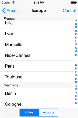
- selecting a city from a list of cities,
- getting the users current location.
- Select the unit of distance: kilometer (km), mile (mi), nautical mile (nm).
This application uses the satellite images obtained from NASAs web site.
The maximum resolution of satellite images in this current version is 4/480 degrees per pixel. This application can be used in offline environment, but will be more limited in resolution.
Credits:
Blue Marble: Next Generation was produced by Reto Stockli, NASA Earth Observatory (NASA Goddard Space Flight Center).
Natural Earth: Free vector map data @ naturalearthdata.com.
Airport data from OurAirports (http://www.ourairports.com/data/).